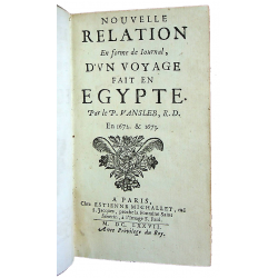


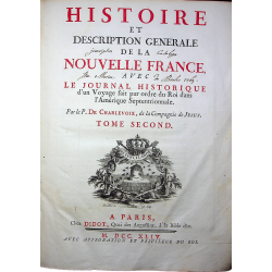
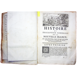
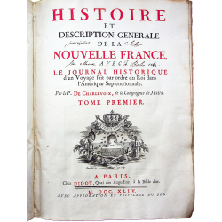


Histoire et description générale de la Nouvelle France, avec le journal Historique d’un voyage fait par ordre du Roi dans l’Amérique Septentrionale.

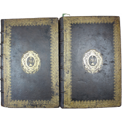
In Paris, chez Didot – 1744. 3 volumes in.4, speckled calf, decorated ribbed spine (contemporary binding). Old restoration on the binding. Traces of wetness. From the Brolio Library 1765 with handwritten bookplates on the titles.
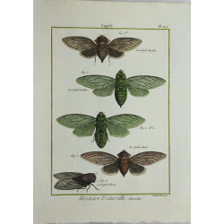
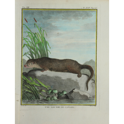
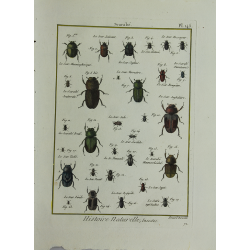
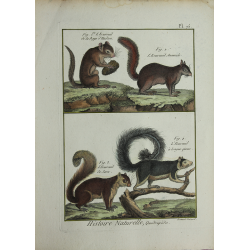
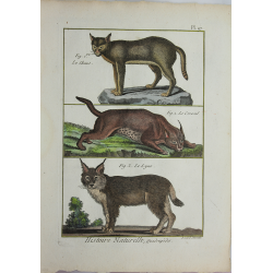
First edition with 50 engraved plates and maps, most folded.
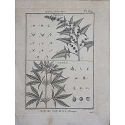
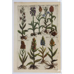
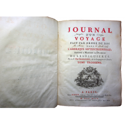
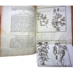
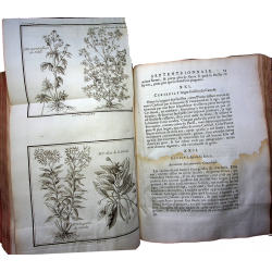
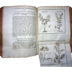
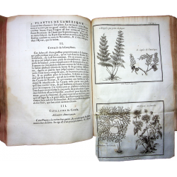
By Father de Charlevoix, of the Society of Jesus Rare first edition in quarto format of this very complete work on the history and geography of North America, which constitutes the culmination of the historian's career from Charlevoix. His story is an original creation since he visited most of the sites and consulted all the available documents. An edition in six volumes, in 12vo format, was published the same year. The publisher has also indicated for certain plates such as those of the plants of North America, their correspondence in the small edition (for example, "Oregano of Canada", page 2 of the quarto edition, page 302, edition in-12). At the end of volume II, after the last book of the "History and general description of New France", which ends on page 582, the pagination starts again with: "Description of the main plants of North America" (pages 1 -56), which is a botanical atlas project. The title of volume III is: "Journal of a trip made by order of the King in North America, addressed to Madame la Duchesse de Lesdiguières". This last volume contains letters I-XXXVI of the travelogue. The first title relates the history of New France from the beginning of colonization until 1732. Ordained deacon, Charlevoix made his first stay in 1705 in New France. He was sent there to teach grammar at the Jesuit college of Quebec where he remained until 1709. At the time he was in daily contact with the veterans of the Canadian missions who lived in retirement at the college: Louis André, who had passed 12 years in the Baie-des-Puants region (Green Bay, Wisc.), Pierre Millet, missionary to the Onneiouts, and Antoine Silvy, who had experience in Hudson Bay. His "History and description of New France" was written in France and supplemented by the historical journal that Charlevoix had written during his second stay in North America, from 1720 to 1722. The regent, Philippe, Duke of Orléans, had entrusted him with a mission: to examine the numerous rumors relating to the existence and geographical location of a Western Sea which would separate the New World from the East. The French authorities hoped that a thorough investigation, carried out by an impartial agent, whose travels would appear as visits to various missions, would avoid unwanted publicity and costly expeditions. In this journal, we find a good description of the social and economic situation in New France at the time. A Jesuit, missionary and historian, the author belonged to a family of ancient nobility which for centuries had provided royal officers, aldermen and mayors to the town of Saint-Quentin.
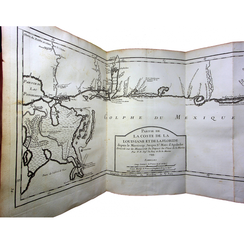
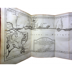
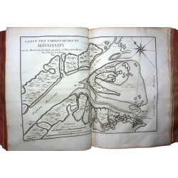
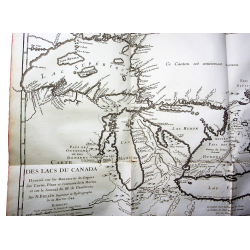
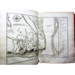
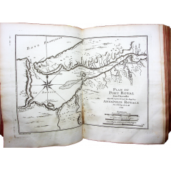
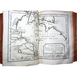
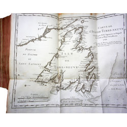
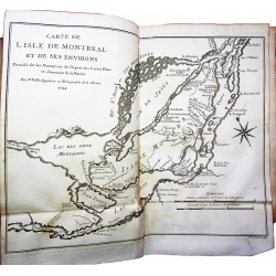
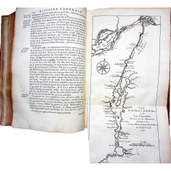
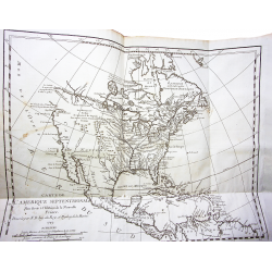
The engraved maps and plans of the work are: Map of North America, map of Acadia, map of the coasts of Florida Françoise, map of the Richelieu River and Lake Champlain, map of the Isle of Montreal and its surroundings, map of the Island of Newfoundland, map of the bays, harbors and marina of the Island of Newfoundland, map of the eastern part of New France or Canada, map of the bay of Hudson, map of the Hudson Bay fund, map of Louisiana, course of the Mississippi and neighboring countries, plan of the royal port in Acadia, plan of the port of La Haive, plan of the bay of Chedabouctou, map of the Isle royale, plan of the city of Louisbourg, plan of the port Dauphin, plan of New Orleans, map of the Western Ocean and part of North America, map of the course of the Saguenay river, map of Isle d 'Orléans, plan of the Quebec basin and its surroundings, plan of the city of Quebec, map of the lakes of Canada, map of the strait between Lake Superior and Lake Huron, map of the mouths of the Mississippi, map of the coast of Louisiana and Florida, plan of Pansacola Bay.
Histoire et description générale de la Nouvelle France, avec le journal Historique d’un voyage fait par ordre du Roi dans l’Amérique Septentrionale.